
Then out on the road...noting the Blackhawks and Chinooks out on the tarmac at Fort Riley.

We have in times past made it a point to visit the two museums here (US Cavalry Museum and 1st Infantry Div Museum) but we were behind schedule and twas not on the agenda.

The M65 "Atomic Annie" on the hill overlooking the fort; capable of firing the 15 kiloton W9 nuclear shell 20 miles.

We stopped for gas a couple times. In the restroom I was put immediately in mind of Jiminy Glick's surreal question to Larry David about urinal dividers "taking the fun out of urinals". But I didn't want to be "that guy" taking pictures of said urinal dividers in a public restroom, so here's Jiminy instead.
An active (and decorated with Christmas lights?) oil pump jack.

Hooray it's still there! Updated for 2024! I mean, it would kind of be disappointing to see these people lose their faith.

Another roadside attraction...the real-life City Wok in Colby Kansas!

At one point in the drive I had purchased a spicy beef stick, not realizing that it wasn't terribly easy to eat while driving, and so Debra would hand it to me and I'd take a bite. However, to her enduring annoyance, I mindlessly added a "chomp" type sound each time, like the sort of sound you'd make when pretending to be a dinosaur eating a toddler's fingers or something. She explained that she would stop unless I stopped doing the chomp sound. And I tried, I tried, but there was a broken spot in my brain and I still found myself subconsciously making ridiculous chomp noises.
Kansas is, well, kind of boring to drive through so that late afternoon tiredness builds up, and I had to have Debra recount for me the recent story of a person she knows, who unburdened themselves recently as to the craziest conspiracy theories they had soaked up from the internet. Not necessarily QAnon but wild and crazy stuff...to paraphrase Douglas Adams from his Dirk Gently novels, he "was even beginning to believe things they'd have difficulty believing in Salt Lake City." Anyway, it was entertaining, and got us into Colorado:

In a rash of cruelty I let the kids get Necco wafers...it's not exactly the worst candy ever devised, but it is definitely one of the worse ones when stacked up against their modern competitors. The kids weren't enthusiastic in praise of them, nor were they put off...you don't look gift candy in the...mouth?

North of Denver we stopped at one of California's better exports:

Good stuff as always.

While our timing was off to sample their legendary breakfast pizza, we gassed up at the local Kum and Go, who maintains a surreal online Twitter brand presence.

Then up into Estes Park to the Valhalla Resort, per our usual plans. Local lagomorph we spotted, that subsequently gave itself an extended dust bath.

Debra's sister, brother-in-law, and young nephew gentleman were out to share a cabin with us for this trip. The cabin had accidentally not been properly cleaned when we arrived, but the staff rallied quickly to put that right, while we went to play miniature golf.

Tetherball always a preferred activity.

Next morning we had a reservation for entry into the Bear Lake Corridor, so we all piled into their large rental SUV and headed into the park for a moderate hike to Emerald Lake. Magpies while we waited in line...

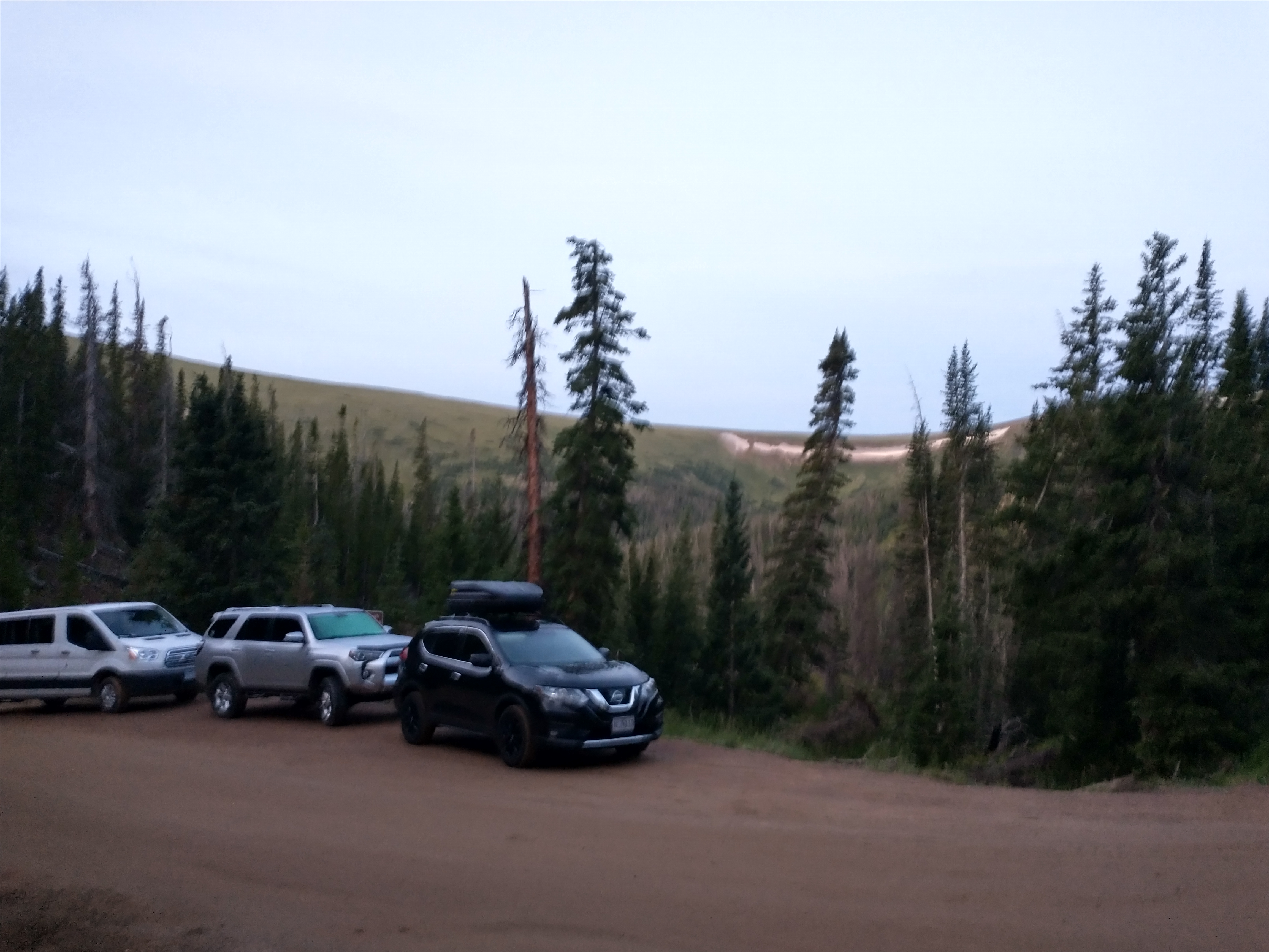
Fantastic luck that we managed to get a spot there:

Found a tiger salamander on the trail...

First lake was Nymph lake, one of the smaller ones, and obviously, lower elevation.

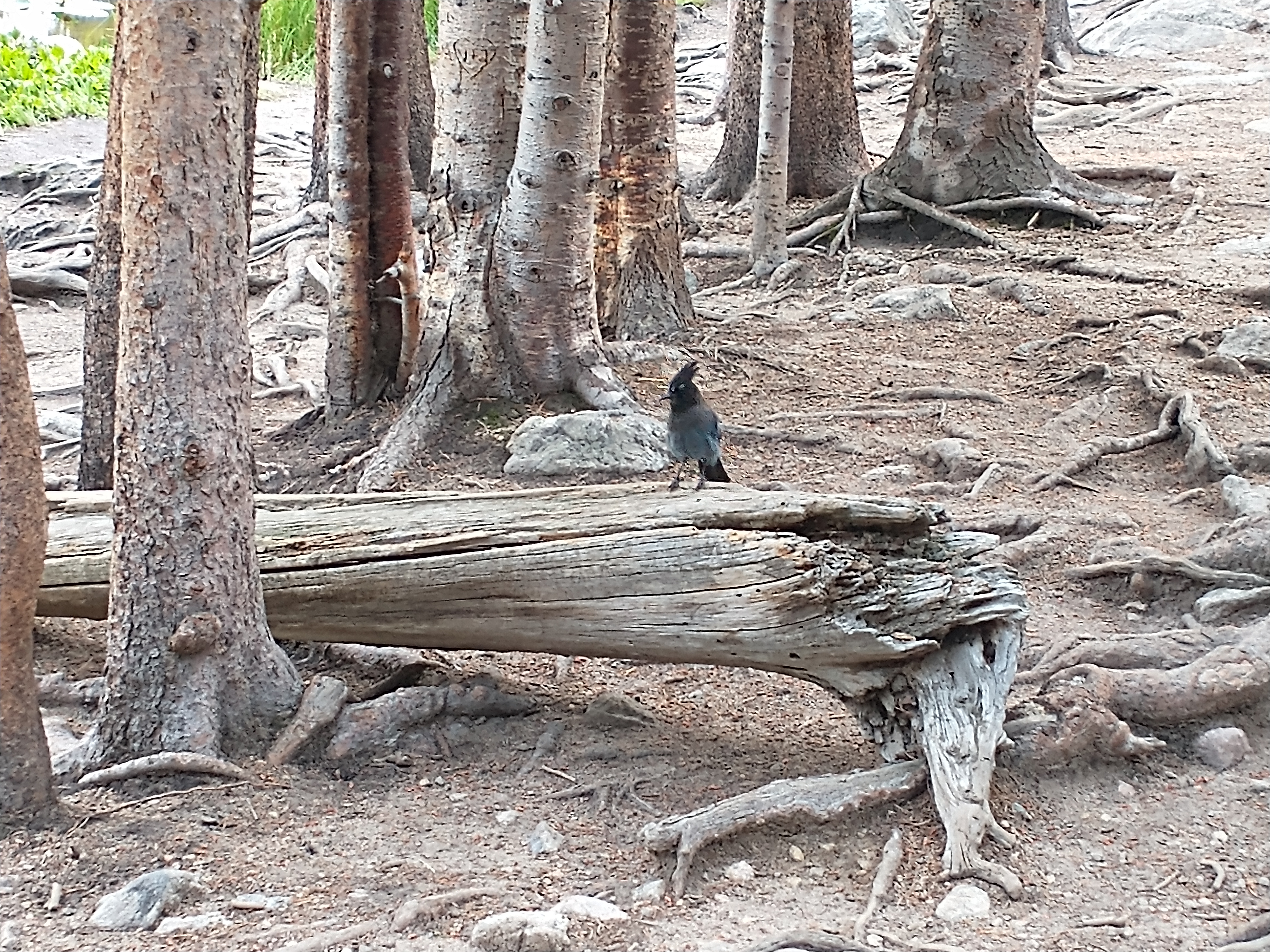
Stellar's jays here.
It's basically 3 lakes with a steady climb to each of them.

Some nice views though.

Chipmunks here know the deal, they are not afraid.

Long's Peak definitely stands out from many points in the park.

A stream rushing down towards Nymph from the second lake, Dream Lake.

In our abortive 2019 attempt to climb Flattop Mountain in the snow, we at least got up to a point in this picture, at the Dream Lake Overlook. It's a good ways up there to do in snow shoes.

This is the eastern side of Dream Lake (which is fairly long).

Pete wastes no time when rocks are to be climbed.

After a snack break we continued along Dream Lake towards the next incline.

The reflections were very clear...a nice parallel image to it. You can almost hear Bob Ross.

Ascending again for the final uphill leg.

Waterfalls throughout.

It's about 3.6 miles round trip with a decent vertical gain, so not terribly gruelling, but a bit more of a hike than a stroll (the RMNP visitor guides had humorously divided "Hikes" and "Strolls", perhaps in an effort to keep the casual tourists from overestimating their abilities).

Getting close to Emerald, Hallett Peak looms up ahead. It was my intent to climb this in 2019, but bad timing and snow won out.

I just want it to be known, I did my due diligence and googled "Indian Paintbrush" to make sure this was still an accepted name (I think so?).

Emerald Lake:

Hallett again to the left, and the ridges to the right are a bit of an illusion in that they are much lower than the mountain that is behind them...the much less dramatic and aptly-named Flattop Mountain. We were planning to loop round Flattop through the saddle up to Hallett.

When selecting pictures for the blog, I realize...you know what, a lot of these are redundant...but then I think again and am like, these were relatively hard-won. Who cares if I have a few too many pictures of a pretty place?

Yep, not apologizing.

Snacks and chipmunk defence while we waited to start the downhill return.

I was surprised to find as many raspberry bushes as I did! These were just barely getting started with some white beginnings of berries, while our bushes at home had long since exhausted themselves with a massive bumper crop many weeks before. The reason should be obvious..."summer" had just barely started here, at this elevation, from the plants' perspective.

Catch and release only at Dream Lake...saw several anglers with their eyes out for fellows like this.

Peter exclaimed a bit of urgency as we headed back down. Normally on a remote wilderness trail we might have asked for a bit of grace on the whole "pack it in, pack it out" rule and found a tree that perhaps needed some watering, but this was an extremely well travelled trail, so I urged him to do his best and we made a quick pace down the trail ahead of the others. To hear his telling, barely on time...

Back at the cabin, we made lunch of ramen noodles and, for the adventurous, "Fire Chicken" buldak ramen...the normal one and the 2x Spicy one, which I had. It stings the nostrils...in a good way.

We had our lightning detector, given the sporadic sprinkling the afternoon brought, but the boys enjoyed a swim at the well heated pool. They kept it toasty, making it all the more brutal getting out into the chilly wind, later. Thanks to the bro-in-law for a nice dinner of spaghetti, bread, and salad.

I should say that the plan heretofore that I had devised was this...the first day, Emerald Lake hike to start to get acclimated. The second day, the 6 mile Deer Mountain hike...a great intermediate hike that kids had previously proven themselves up to, with excellent views of the park from a central location. Then the third day, our last in RMNP, would be my solo attempt at the Chapin-Chiquita-Ypsilon 3 peak circuit. The unfinished business that had haunted me for years. However, on the hike back down from Emerald, I had divined that the appetite for doing Deer Mountain the next day was...fairly slim. On the idea that giving the rest of the folks a day off to either explore or rest might increase the odds of participation at Deer Mountain, I proposed (and the others had no objections) that we change the schedule and I try CCY next day, and Deer Mountain maybe the day after. To give a bit of history, a summary of my CCY attempts over five years:
2018: My first attempt; I was in good physical condition (it being the year I tried for a commission in the Navy Reserve), but after I summited the initial Chapin (12.5k) and Chiquita (13k), I looked at my Garmin and misinterpreted the time because of time zone issues, and believed I was out of time and could not safely summit Ypsilon before noon. Back down I headed, leaving the circuit incomplete.
2019: My second attempt, sort of...intended to go with Debra this time so she could see the pika that were crawling all about the place. We foolishly booked in June, without me thinking about it. The Old Fall River access road itself was far from being cleared of snow and open, so we were forced to find an alternative hike and leave CCY for a future attempt...this is the year we attempted Flattop and Hallett with the aid of rented snowshoes...and turned back just shortly past the Dream Lake overlook thanks to the complete vanishing of the trail into deep snow.
2020: We were booked to stay this year, this time in late summer to not make the same mistake twice. Then came...well, you all remember all too well. Plans were scuttled and reservations cancelled.
2021: Finally back, and again attempting with Debra to see those blasted pika at last! Old Fall River road was open, our kids were with family back at the cabin, and we made our attempt. Unfortunately, unlike in 2018, the wind was bitingly cold. We summited Chapin, and I took one look at Debra who was, I have to say, a pretty good sport, but let's just say she was quite pleased when I said we could call it a day and leave it just at Chapin. Given our slowness on the ascent, we wouldn't have made it all the way to Ypsilon anyway.
So it's 2022, and we're back, and I've got unfinished business. Solo hiking again, because Debra had seen the pika and felt no driving need to do the rest of it. I was up at 4, slugged down an apple, a protein bar, and some cold instant coffee I had prepped the preceding night, and then packed/dressed and out before 5.
Pulling up to the entrance at 4:57 or so I saw the light on at the station and was thinking, dangit! I've actually got to pay for park entry! But pulling up to the window I saw these beautiful words...Station Closed Please Proceed. ONCE AGAIN getting away with not paying. (If this was Disney you know they'd have had spike strips and full staffing at 2am, ain't nobody get something for free there.)
Because Debra was not with me I was free to indulge in my favored listening material for driving pre-dawn through the mountains...Wagner's condensed "Symphonische Ring", the Ring Cycle without singing and abridged into a 90 minute highlight reel basically. Believe me, the Ring benefits from editing. Now the following (Ring Without Words) is not my preferred version because it criminally rips out the finale of Die Walkuere, Feuerzauber, with Wotan giving Brunnhilde the sleeping pills and doing the whole "wer meine Speere's Spitze fuerchtet, durchschreite das Feuer NICHT!" routine...great stuff. The finale of Goetterdaemmerung is the only bit that can compare. But this version is good too, and keeps most of Wotan's lament from that section.
Nothing makes me feel more German than alpine climbing, listening to Wagner,

A fuzzy photo but a good approximation of this delightful white-knuckle type drive. 15mph as a speed limit, and believe me, you'll want to abide by that. Switchbacking up a cliffside basically on a one way dirt road. With some fortunate timing, just as we passed something ominously named "CHASM FALLS" (I suppose they could have called it "FALL TO YOUR DEATH IN THE CHASM FALLS" to be fair), the Walkurenritt (Flight of the Valkyries) came on and I was spurred on...

The sunrise getting started. It's not a long drive, less than 10 miles I believe, but it takes a long time.

And I found a spot at the trailhead. In front of me was a group of young Girl Scouts (or other young teenage girls in a group) just like I ran into in 2018, when they completely outpaced me. I was pretty sure they'd completely outpace me again but it is at least a bit funny, being bested by a group of kids who were probably hampered by their slowest member. As I got ready to go, I could tell it was warmer than the previous year, so I went down to shorts and short sleeve layers.
The mountains in this area are so beautiful at this time of day. It's a shame that your brain, at the time, is more obsessed with thoughts along the lines of "WHAT IS THIS THIN GRUEL WE ARE BREATHING STOP STOP I NEED TO REST" and "OH GOD NOT ANOTHER STAIRCASE".

Turns out, the "purple mountains' majesty" of "America the Beautiful" was composed in Colorado Springs after a trip up Pike's Peak. They are beautiful (though the plains surrounding are rather sparsely fruited).

Looking back, you can see (just barely) the Alpine Visitor Center along the Trail Ridge Road. Debra and the rest of the family were tentatively planning to visit there and would try to spot me, somewhat unseriously, from there later.

The first leg is just a number of segmented climbs, until you get above the tree line to the sides of Chapin. I met an older lady who breezed past me at speed on the trail, and we chatted briefly and she flied on upwards, impressively.

High up on a rocky promontory, looking down on the valley below.

Fuzzy due to low light and digital zoom, but noted several bull elk that were quite close to the trail I had just ascended past.

Then just past the tree line, I ran into aforementioned Girl Scouts...the idea that I had caught up to them, at my snail's pace, seemed dubious. The leader was a bit ahead and I realized why they had stopped...faintly visible in this picture but VERY visible in person, a bull elk was squatting on the trail. The older lady I had mentioned earlier had taken an off-trail path to the far right to skirt past the elk, and I briefly considered whether waiting for him, or following her lead, which I eventually did.

As I went uphill and gave the elk a wide berth, he kept giving me the eye. Eventually he moved on downhill and the Scouts were able to proceed, and I eventually got back on the main trail.

Another close encounter as I got into the talus fields on the flanks of Chapin...a muley buck on the trail. He's in a bit of a depression here, but a pretty substantial fellow. Fortunately I'm a little more at my ease with deer than elk, having been, err, up close and personal with them from time to time, so I advanced cautiously and slowly to encourage him to move off. He eventually did.

The pikas were, as previously, a bit thick here. I took a video of this chap, or at least I thought I did. In fact I thought I started the video and then stopped it after a few seconds of adorable antics, but I actually started it when I thought I stopped it, so there was about 10 minutes of video starting with me pocketing my phone, until I realized later it was still recording.

The sun came up in earnest over Chiquita and there for a while you just had to trust that you were vaguely in-line with the trail and just stare at your feet to negotiate the rocks. This was mostly past the talus fields where the path up to Chapin's summit began.

Chapin was, well, hard. My lungs were still in complete opposition to my intended goals and were not at all happy. I did the usual trick of counting to myself to a fixed point, 30-50 or so and giving myself a breather before forcing myself onward. As I alluded, I'm not in the shape I was in 2018...for various reasons I've been doing more distance walking (about 5mi per day usually at 3mph) than running or incline work; that was probably a mistake. I felt it. It's hard to describe how demoralizing and awful it felt going up...a mix of "I'm not going to be able to do this" and "holy heck my lungs are useless"...I know, I'm selling the hiking experience really well...but the mood shift once I had reached the summit is also hard to describe.

It really is the agony of ascent, the ecstasy of descent.

Next up, the daunting and seemingly endless ascent up Chiquita.

A look back at Chapin as I inch up Chiquita, a bit at a time.

Looking off to the more remote northwest mountains, before the trail turns to barely marked talus field.

Seemed like miles of "choose your own adventure" talus here, with only mild hints and occasional cairns implying a semblance of a trail. This is a hike for people who don't really need a trail to guide them...thankfully I had both experience here and a very good Garmin satphone/GPS.

I sat down, exhausted, atop Chiquita much, much later, next to a shelter. I wasn't drinking enough water I was sure...it was such an investment to take even a swallow of water when that second of swallowing was one where your lungs had to pause their relentless attempts to pull oxygen from the atmosphere.

Surveying the valley below, with my last objective, Ypsilon, stretched out to the left.

My little furry marmot friend, the True Lord of the Mountaintop and Anointed Sampler of All Provisions In Unguarded Packs.
From Chiquita there was a mostly unmarked descent down the boulder field towards the saddle...a loss of altitude that I'd no doubt be paying for. From the saddle I steeled myself (perhaps not the right word as it implies a certain exceptional toughness that I in no means lay claim to...perhaps I paper-mached myself? I braced myself with balsa wood supports?) for the final, goal-fulfilling ascent up Ypsilon.

It was lonely on the ascent...aside from one person I met much later, I had most of the mountain to myself. With each subsequent mountain, the trail became more "freeform" and it was mostly unmaintained here and a pick your own way up type affair. The peak to the right in this shot is a false summit, for sure.

Looking back down, Chiquita looked kind of small and low at this point.

I crested one of several false summits to see this final summit, which initially disheartened me (it looked absolutely massive in person, not conveyed properly in these small images), until I saw the person walking down it for scale, shown in the photograph. Wasn't too bad after all maybe.
It turned out to be "old woman from scene 24" (name that movie), the sprightly, pole-free woman of later middle age who seemed to take these three mountains without any trouble at all. Good for her! We talked very briefly and she congratulated me on my first successful (at least, we hoped, there was still a ways) completion of CCY, and I asked it there was much of a trail back...no, a few cairns but mostly "bushwhacking". Off she went...

Still a ways to go but the rock formations near the edge were amazing.

Ahh, a glacier or at least snow field. I did not approach it!

Getting closer still. See my earlier comment of refusing to apologize for too many pictures...these pictures are among the hardest won of any I've taken, so into the blog they go!

A better shot of the Baby Glacier.

Then finally from the top. I sat my posterior down and ate some almonds, which may have been my first bit of food to that point. I wasn't hungry, but the profound fatigue I enjoyed on the way back may have been partly contributed to by my seeming inability to fuel and replenish water in my system.

It was beautiful...I was completely exhausted. But I'd done what I had set out to do. There was a long way to go yet, but it was before noon, I had climbed all three, and the trip back was a difficult, long, but most importantly level or downhill route back.

I wished a good hike to these three that arrived just before I left and started picking my way down the mountain.

You need good boots and strong ankle support for this. Like she mentioned, it was bushwhacking for most of the return until you got to the Chapin Chiquita saddle where trails were more clearly marked.

Gleaming white rocks in spots, after having reached the Ypsilon-Chiquita saddle. My route, to avoid ascending Chiquita again, would be to route around the mountain at the saddle level, through some messy rock fields filled with pika.

Pretty mountain flowers, a good reason to stop my exhausted legs for a few seconds.

Once out of the rock fields and onto the regular trail, the going was much easier on my legs and feet, and it wasn't a constant effort with my poles extended to avoid falling or slipping, as it was on the steeper descent sections. Would've been even a pleasant amble I think, aside from the profound exhaustion. But the treeline was in sight. I've written about the false-summiting phenomenom before having an equivalent "false-parking-lot" thing, and with each descended staircase I would think, surely, the road is around the next bend? And time after time, it wasn't. But it was a relief just to know I was getting close.

Noted this failed section of bridge. On my way across it in the morning, the one side felt significantly spongier than the other, like it was rotting. No surprise that on my return, someone had had the unfortunate experience of breaking it on their way across. Hopefully they were OK! I reported it the next day to a ranger who said they'd let the trail folks know of it, and then subsequently stared at me with dead eyes making no move to either write it down or pick up a phone or anything. Yeah, sure you will buddy.

I eventually got to the parking lot with a mixture of emotions. On one hand, I was elated that I had completed a long intended, though completely arbitrary goal of mine. Even in a state where I was not optimally conditioned, and certainly beset with enough valid self-doubt to have given up at many points when the difficulty was making itself known; sort of the hard-headed, bloody-minded stubbornness that can be both a vice and virtue depending on the context that propelled me on in spite of that. It's the kind of thing I want my kids to develop...not just a pig-headed insistence to not adapt or make changes (that being the "vice" side of that quality), but at least a willingness to attempt hard, sometimes seemingly impossible things...sometimes for no other return on the investment than the feeling of accomplishing it. And sometimes you'll attempt things that are extremely unlikely or difficult, and you won't succeed (see: USNR commission in late 30s without prior service...was not attained, but I gained a lot of good experience and knowledge in the attempt), but those experiences can be just as helpful. But working past the fear of trying I suppose. I'm awfully old to be learning some of this stuff now, but such as it is. Not to get too philisophical, anyway. The other emotions were "oh my God I'm about to pass out how am I going to be able to safely drive down that harrowing Trail Ridge Road to get back"...but once I sat my tired white ass down in my car, just the very act of not continuously walking for the first time in hours let me rejuvenate enough to feel fine driving back. I headed up the rest of the Fall River Road, and found the Alpine Visitor Center well attended as usual. I found out later, Debra and the others were up there maybe just 15 minutes before! If our communications had been better, she could have waited for me and driven me back, but no worries.
I should also say that my post hike plans had evolved. At first I told myself, after I get done with this hike, I'll drive into Estes Park, get a celebratory McDonalds lunch (I know, I do live the High Life) and go to the store, pick up some fresh food for that night. Later into the hike I was thinking, oof, I'm so tired, I don't want to do all that. So what if I just park at the Alpine Visitor Center, go into the restaurant and order a hot dog? Much later in the walk as I had reentered the tree line, I considered the plans again, including just the tiny bit of walking from the parking lot to the restaurant and I believe my exact spoken words to myself were, in the squeaky, asthma tinged voice that I had achieved from hours of walking in an oxygen deficient environment "$%^# THAT NO MORE WALKING", if readers will excuse the profanity (only bears and elk were about to be offended).
On the drive back, a beautiful sight of Long's Peak. All that bluster about doing hard things...do hard things that are not likely to get you killed, cause that one, Debra would veto in an instant. It's pretty to look at though! But a deadly destination for the unskilled (of whom I am chief).

I arrived back at the cabin, and Debra came out to greet me, and subsequently and justly, laugh at me. I looked, accurately, a sight. My voice was hoarse as if I'd been shouting, but that just came from gulping air through my mouth like a landed catfish all day. I think in total I had done about 9+ miles, with somewhere between 3500-4000 feet of ascent...a decent amount of sunburn and windburn too, and since (despite the initially chilly temps) I had been sweating pretty constantly all day (and not resupplying with water frequently enough) my clothes were covered in salt stains from sweat, and I noted a crusty grainy substance covering my forehead and eyelids...salt from sweat!
I should say, our original plan was, after leaving Valhalla and Estes, we were going to drive down to Georgetown Colorado...doing both the (reserved) drive up to the top of Mount Evans, and then while the family stays in a local hotel, the next day I would attempt to climb Mount Bierstadt, in what would be my first 14-er. However on the walk down I had made the snap decision that accomplishing the CCY was the bigger and more satisfying of the two potential accomplishments, and doing another hike, even a 14-er, would be a bit anti-climactic. Debra and I love cancelling or more accurately, shortening vacation plans, at times. So we nuked our reservations and resolved to drive home just after our Valhalla stay, and leave Mount Bierstadt for another time.
That afternoon I unsurprisingly rested, and the family made dinner (chicken fajitas). Later in the evening, after basking in the rehydrating (sort of) effects of an IPA, I granted the prospects of the planned Deer Mountain trip the next day were not highly probable, so maybe instead, we let the other folks (who were newer to Estes Park area and wanted to explore more) kind of take the lead the next day, and we just tag along. Deer Mountain, too, would wait, and we might get to see some spots I hadn't bothered planning an exploration of, before. Everybody wins, not least my feet.
A slow morning at the cabin the next day and we headed in around 9am to the park. First stop at the overlook of West Horseshoe Park...a rather nice view of my friends from the day before Chapin, Chiquita, and Ypsilon. Fairchild Mountain, mercifully exempted from the common definition of the circuit, is off to the right.

Did Dick and Jan actually die right here? What the heck. KIDS GET AWAY FROM THE EDGE

Nephew headed off with his dad to climb down the trail a bit while our kids climbed on the rocks.

It's a nice overlook at a central part of the park, just north of Deer Mountain as it happens.

From there to Sheep Lake...so named, because it is shaped like a lake (I will never turn loose of that joke, Debra, never!). The lack of big-horns there had us quickly abort though, and so we headed to the Alluvial Fans trail to walk a very tame path to a nice waterfall.

It was paved and everything. Luxury.

Granted the whole "leave no trace" thing, but I was very pleased to see ripened (or nearly so) raspberries on this bush. Because I was confident (having harvested probably 500,000 raspberries from our two bushes this year) in the identification of the plant and wanting the, I dunno, thrill of foraging food in the wild (see previous mountain apple discovery), I snuck a single raspberry. A bit tart, and given the well travelled nature of this path and the prodigious raspberry bushes everywhere, the bears won't keenly miss it.

Kids liked climbing on the rocks.

Here's a good example to back up my raspberry identification...this looks vaguely raspberry like, but distinctly different from raspberries I was familiar with. Research indicates it -might- be the edible "mountain raspberry", not prized for its flavor, but at least safe. That is from my after the fact research. Just like with mushrooms, if you can't positively identify it...leave it alone.

Climbing up the rocks...I think that may be Deer Mountain to the right.

We stayed here a bit, as the others took (better) pictures...

Video of the falls.
Pete still enjoying the climbing aspects here.

Then back in the car, and we headed down towards where Old Fall River Road ascends...the Endovalley park area. There was some loose talk of walking up the trail to the Chasm Falls area as they were curious about it (if you drive, its a commitment to drive the whole way to Alpine Visitor Center and back...the road is one way).

But we spent time just checking this area out. At the outhouses, it appears you are forced to apply for a PERMIT if you wish to climb into the underground chamber. I thought this was AMERICA! What ridiculous regulatory state overreach! If I wish to climb into a pit of human filth it is my RIGHT as an American!

The place was ideal for picnicking and birdwatching.

There is a sort of yellow bird that sounds like it was a western tanager that we watched over here.

We were relatively deep up in the valley so this is likely recent snowmelt making its way down.

Nice place to wind down our trip.

Stellar's jay again, really pretty bird.

Bit of video of our jay friend.
Then a brief amble back at the visitor center, which we stopped at for...we're not sure why? We didn't buy anything.

Once back at the cabin, I went to the office to ask for another box fan to help drown out a bit more of the noises during the night. (It worked like a charm.) On the way I jump scared a muley doe.

Afternoon rain storms...this (cabin #5) wasn't our favorite, it was a bit cramped in odd ways, but the place is still nice.

The interior of said cabin, just so we can recall it.

That night we had leftovers and did a lot of prepacking. Up early in the morning...but not so early as I had proposed...I tried selling the kids on being up by 5 in order to get back in time to rescue our dog from another two day stay (as they were closed the next day) at the boarder. Apparently their love of sleep won out over their fealty towards their dog (sorry Odin). We got out in good time still and made sure to get gas at my new favorite gas station / convenience store / Twitter persona:

AND THIS TIME WE SAMPLED THE BREAKFAST PIZZA

In Colby Debra tried again to get a good picture of Wheatfield Jesus, the kind of weird and a bit creepy roadside art that is either Our Lord and Savior, or perhaps some random hippy, emerging from a field of grain. This is as good as she got shooting from the hip as it were:

We pulled into a random place for gas and I PROMISE I did not plan this. It was DESTINY. KISMET. THE FATES HAD DECIDED AND IT WAS MEANT TO BE.

Debra conceded I had no choice now but to get some food from there...not wanting to sample their City Shrimp or City Chicken or anything too heavy, I got their City Crab Rangoon, which while not completely objectionable, might be appropriately named. (No, sadly, they do not name their products in accordance to the City Wok of South Park fame.)

One other fun memory from the long trip back...as we pulled alongside a highway patrol officer, we saw a car kind of speeding ahead of us, and passing on the right. I thought, hooboy, wouldn't be doing that in front of this guy, but highway patrolman kept his powder dry. Immediately following first kind of questionable driver came LEEEEROY JENNNNNKINS doing a much faster and more dangerous, cross-three-lanes-at-once move without signalling, right in front of us and the cops. The officer had waited for the right time and snapped his trap shut, lighting off in hot pursuit. It was a delight to see such justice served up immediately.
Kansas is not going to win a lot of beauty competitions for its landscapes but the skies, well, they don't have to compete with much below them, so they do tend to be pretty beautiful at times.

And then because I'm too lazy to figure out where to insert these (at least right now!) a couple pics from Debra's camera, ping pong in the game room:

And animal watching up atop Trail Ridge Road.

We got home safely that evening. Another great trip in the books, and I was able, after about 5 years, to end my white whale quest to complete that CCY hike!